Return
- Products and Services
- Proprietary technology empowers businesses and services.
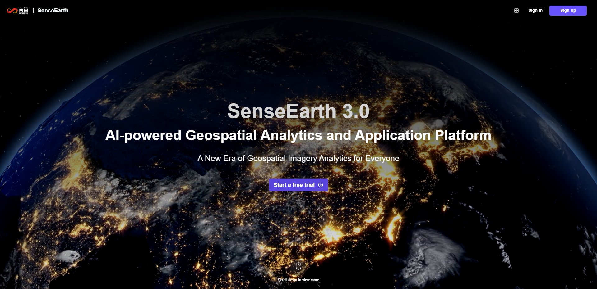
SenseEarth
AI-powered Geospatial Analytics and Application Platform
AI-powered Geospatial Analytics and Application Platform
Product Description
SenseEarth is an AI-powered, cloud-native geospatial analytics and applications platform. Developed based on SenseTime's exceptional large-scale vision foundation model, SenseEarth integrates extensive data products, powerful algorithms for satellite image analysis, and code-free app-building capabilities. Our platform delivers cost-effective and user-friendly solutions that cater to a broad spectrum of industries, including agriculture, finance, energy, environment, and more.
Product Highlights
-
 Revolutionizing satellite imagery applicationsWith the power of our large-scale remote sensing foundation model, SenseEarth transforms the traditional approach to satellite imagery applications by introducing a ground-breaking "Data As A Service"(DAAS) model. Our "AI Analysis Results + Imagery" library allows users to search, browse and download their desired products all in one place.
 -
 AI-powered geospatial analysis capabilitiesEquipped with more than 30 geospatial analysis algorithms, our industry-leading technology covers a wide range of scenarios, including land use, crop recognition, change detection and object detection. Our technology is fully compatible with satellite imagery from different sensors, seasons, regions and terrains.
-
 Map Application Development ServiceProvides a built-in no-code app development service with a rich component set for mapping and charting. Customers can augment GIS maps with graphs, legends, texts, and timelines with ease.
Usage Scenarios
- 01
- 02
- 03
- 04
- 05
- 06
- 07
- 08
- 09
- 010
01
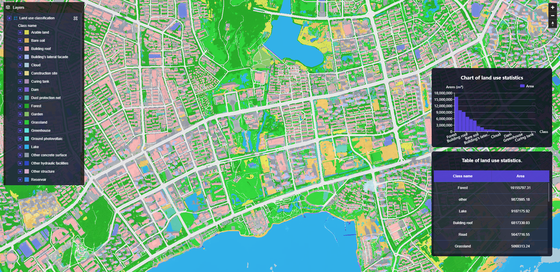
Land Use Classification
Compatible with both drone and satellite images, our solution can extract over 25 classes of ground features automatically, providing crucial data in city planning and surveying.
Compatible with both drone and satellite images, our solution can extract over 25 classes of ground features automatically, providing crucial data in city planning and surveying.
02
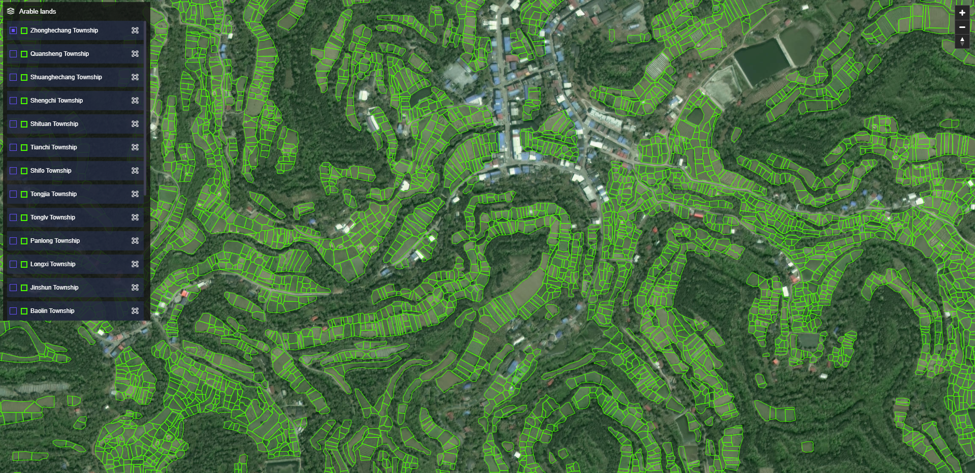
Arable Land Monitoring
The fully automated arable land parcels detection surpasses manual data annotations by 60 times in speed. Instantly visualize the distribution and area information of arable lands, providing valuable insights at a glance.
The fully automated arable land parcels detection surpasses manual data annotations by 60 times in speed. Instantly visualize the distribution and area information of arable lands, providing valuable insights at a glance.
03
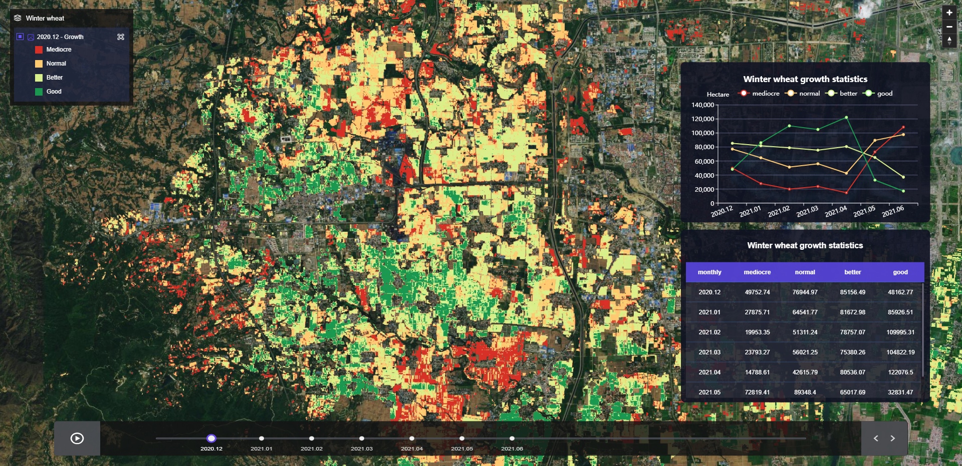
Winter Wheat Growth Monitoring
By utilizing high-frequency satellite imagery, our solution monitors the growth of winter wheat across an entire region. This capability assists in guiding agricultural practices such as irrigation, fertilization, medication, and other agricultural directives.
By utilizing high-frequency satellite imagery, our solution monitors the growth of winter wheat across an entire region. This capability assists in guiding agricultural practices such as irrigation, fertilization, medication, and other agricultural directives.
04
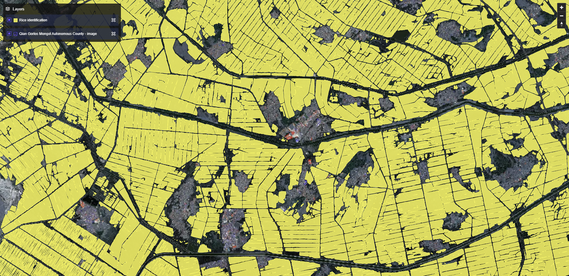
Crop Monitoring - Rice
Monitor the growth of rice and gain instant insights into their conditions and area distribution.
Monitor the growth of rice and gain instant insights into their conditions and area distribution.
05
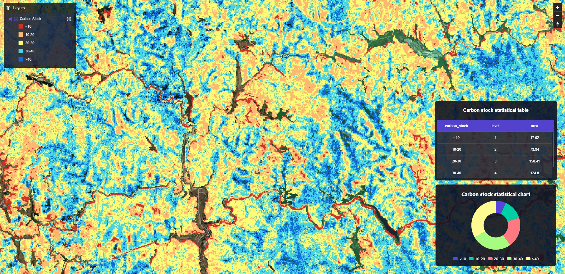
Carbon Sink Value Calculation
Using the light energy utilization algorithm, our solution calculates forest carbon sinks and carbon stocks accurately. By integrating carbon sinks trading prices, we can effectively measure the value of carbon sinks.
Using the light energy utilization algorithm, our solution calculates forest carbon sinks and carbon stocks accurately. By integrating carbon sinks trading prices, we can effectively measure the value of carbon sinks.
06
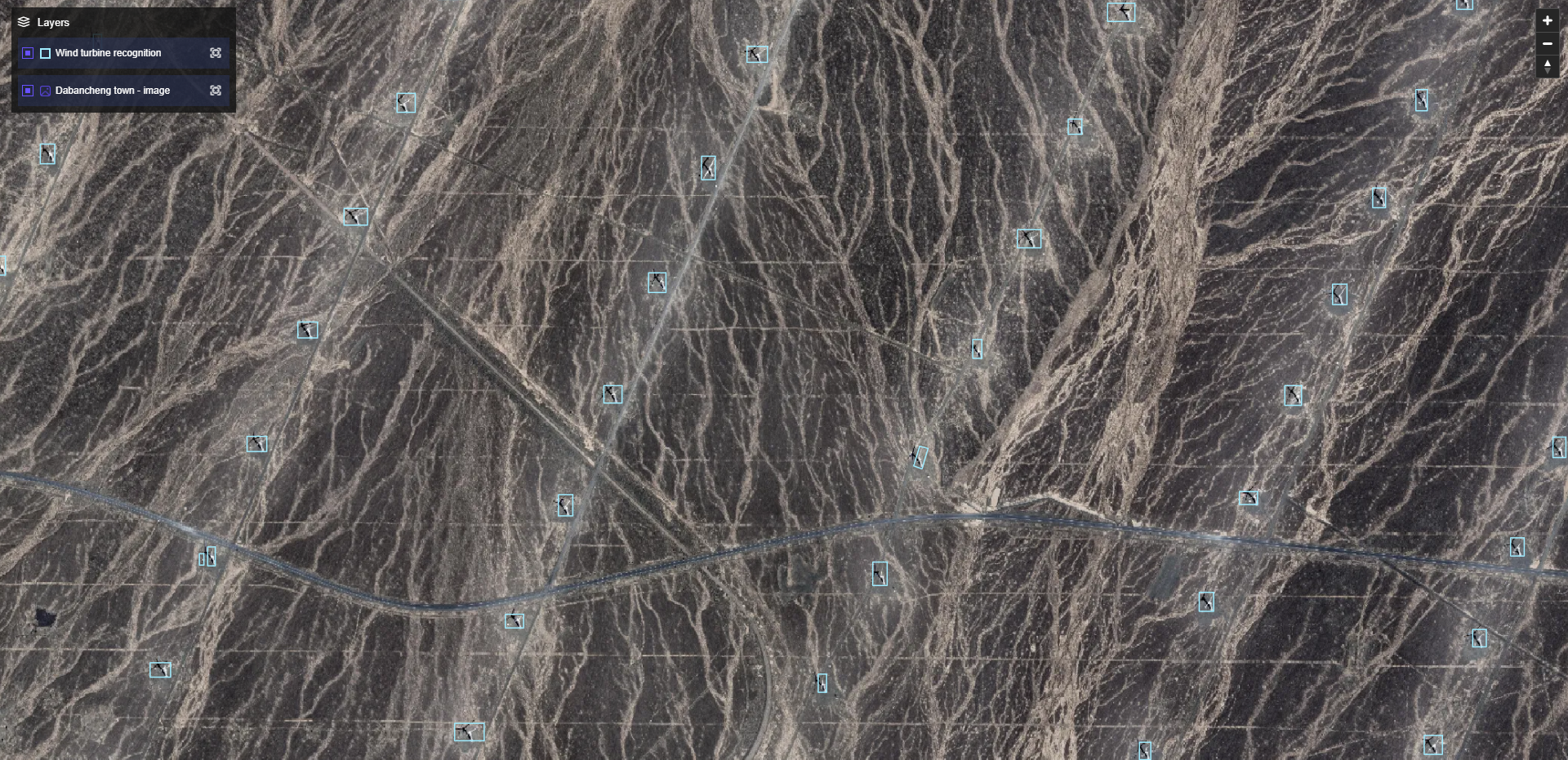
Wind Turbine Detection
Our solution enables real-time detection of wind turbine units, providing location distribution and quantity data to assist in the efficient operation of wind power plants.
Our solution enables real-time detection of wind turbine units, providing location distribution and quantity data to assist in the efficient operation of wind power plants.
07
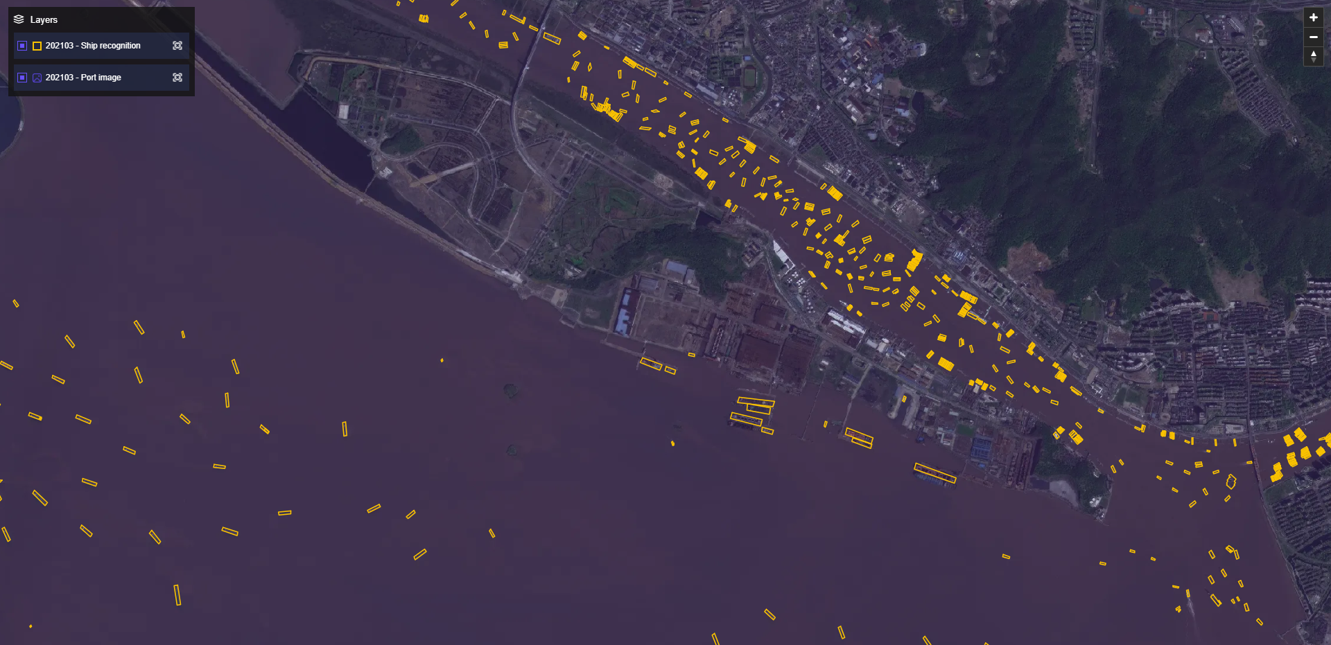
Ship in Port Detection
By monitoring the number of ships docking at the port, we can analyze the import and export activities, providing insights into the financial situation of related operating companies.
By monitoring the number of ships docking at the port, we can analyze the import and export activities, providing insights into the financial situation of related operating companies.
08
Real Estate Development Project Analysis
Efficiently analyse the progress of construction and development in real estate projects, including buildings, roads and other infrastructure. Gain valuable insights into the level of real estate activities in the neighbourhood.
Efficiently analyse the progress of construction and development in real estate projects, including buildings, roads and other infrastructure. Gain valuable insights into the level of real estate activities in the neighbourhood.

09
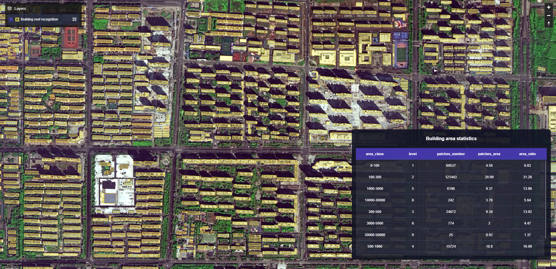
Building Roof Monitoring
Our advanced technology accurately identified the edges of building rooftops, allowing for precise calculation of their area. The photovoltaic industry can use these data to select suitable rooftops for installation processes.
Our advanced technology accurately identified the edges of building rooftops, allowing for precise calculation of their area. The photovoltaic industry can use these data to select suitable rooftops for installation processes.
010
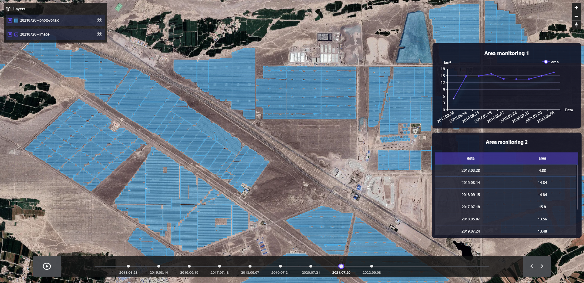
Ground Photovoltaic Monitoring
Auto-detection of ground-mounted solar-panel units enables monitoring of the construction progress of large photovoltaic projects, providing insights for financial institutions when conducting due diligence and investigation.
Auto-detection of ground-mounted solar-panel units enables monitoring of the construction progress of large photovoltaic projects, providing insights for financial institutions when conducting due diligence and investigation.
All Products