Return
- Products and Services
- Proprietary technology empowers businesses and services.
SenseRemote Layers
Geospatial Machine Learning Platform
Geospatial Machine Learning Platform
Product Description
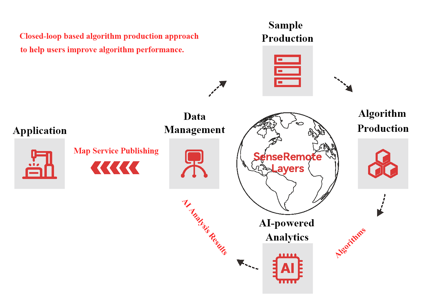
The platform is built on SenseTime's proprietary deep learning framework, offering a fully visualized, no-code user experience. It enables users to create their own AI algorithms tailored to specific scenarios in satellite imagery analysis.
Product Highlights
-
 One-stop serviceOur platform covers the entire AI workflow, from algorithm production to application, making it easier for users to integrate our technology into their day-to-day tasks.
 -
 Fully visualizedLow entry barrier to allow non-AI professionals to get started as quickly as possible.
-
 Feedback loopContinuously improves algorithm performance, enabling scalable geospatial applications and services through machine learning.
 -
 Proprietary AI frameworkLeveraging SenseTime’s extensive experiences in AI and computer vision, we have developed an efficient training framework to address geospatial analytic problems effectively.
-
 Extensive collection of pretrained models with high-precisionWith over 30 pretrained models available, users can achieve customized algorithms with high-precisions using only a small set of training samples.
 -
 Comprehensive post-processing toolsFeatures built-in tools for road centerline extraction, building edge regularization, simplification, and more. These tools enhance the efficient use of analytic results in applications and services.
-
 Direct application of resultsFacilitates the application of analytics results across various industries by offering the ability to edit prediction outcomes and publish map services.
Usage Scenarios
- 01
- 02
- 03
01
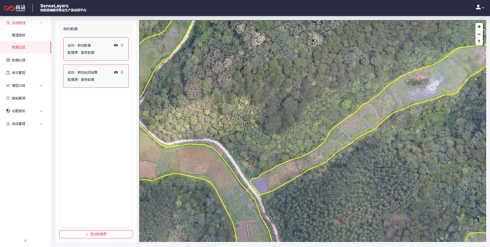
Rapid Iteration of Arable Land Algorithms
In Nanning, Guangxi, China, clients utilized UAV images from the entire Guangxi region to annotate arable land samples. After training and iteration on the SenseRemote Layers platform, the arable land extraction algorithm achieved an accuracy of over 90%, significantly increase the efficiency of their land survey operations.
In Nanning, Guangxi, China, clients utilized UAV images from the entire Guangxi region to annotate arable land samples. After training and iteration on the SenseRemote Layers platform, the arable land extraction algorithm achieved an accuracy of over 90%, significantly increase the efficiency of their land survey operations.
02
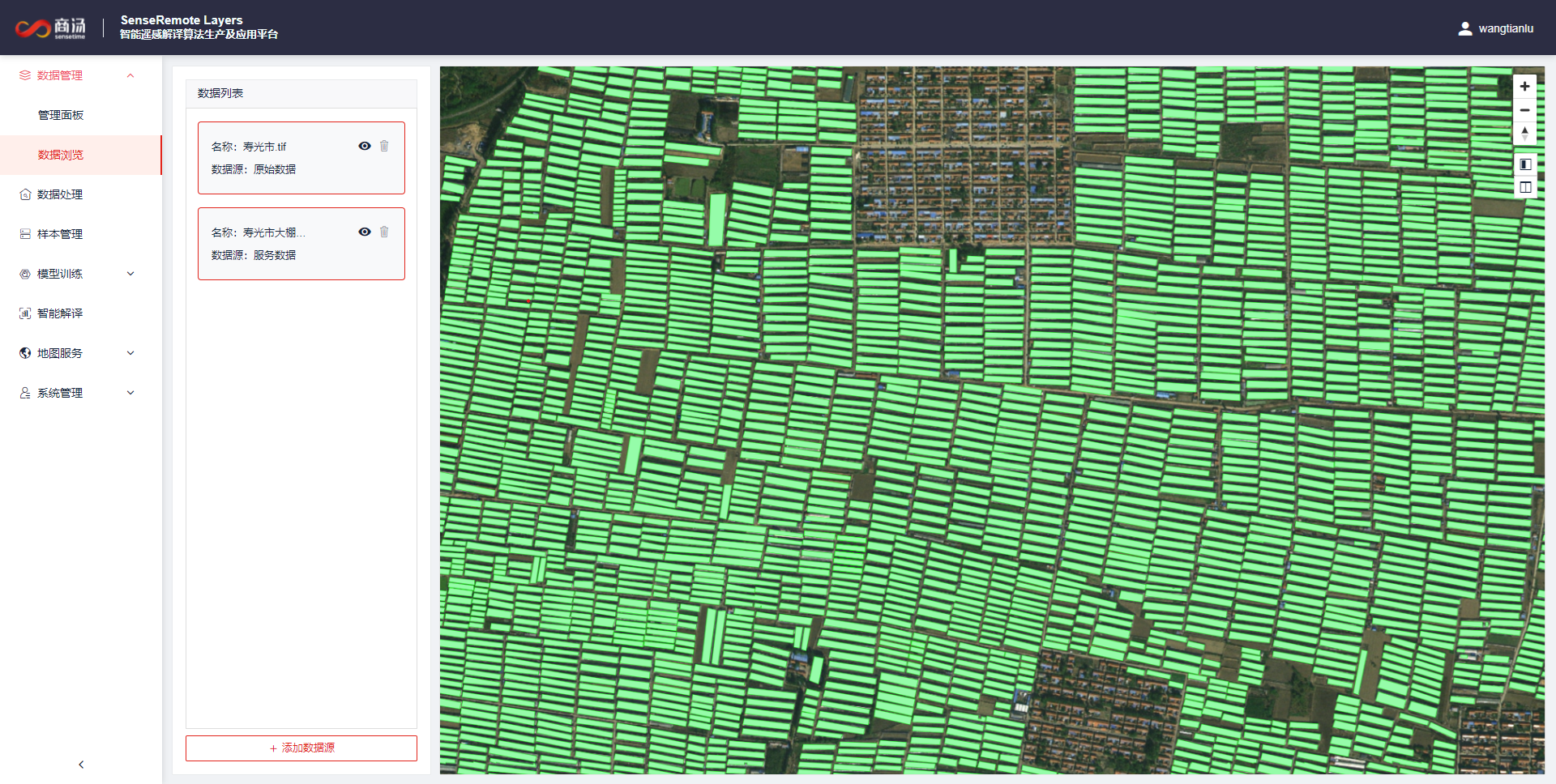
Fast Production of Greenhouse Detection Algorithms
In Shouguang, Shandong, China, customers used the platform to quickly generate a greenhouse detection model with a training set of less than 1000 samples. This algorithm provides great support for the development of the vegetation industry in Shouguang city by improving the automation of greenhouse detection.
In Shouguang, Shandong, China, customers used the platform to quickly generate a greenhouse detection model with a training set of less than 1000 samples. This algorithm provides great support for the development of the vegetation industry in Shouguang city by improving the automation of greenhouse detection.
03
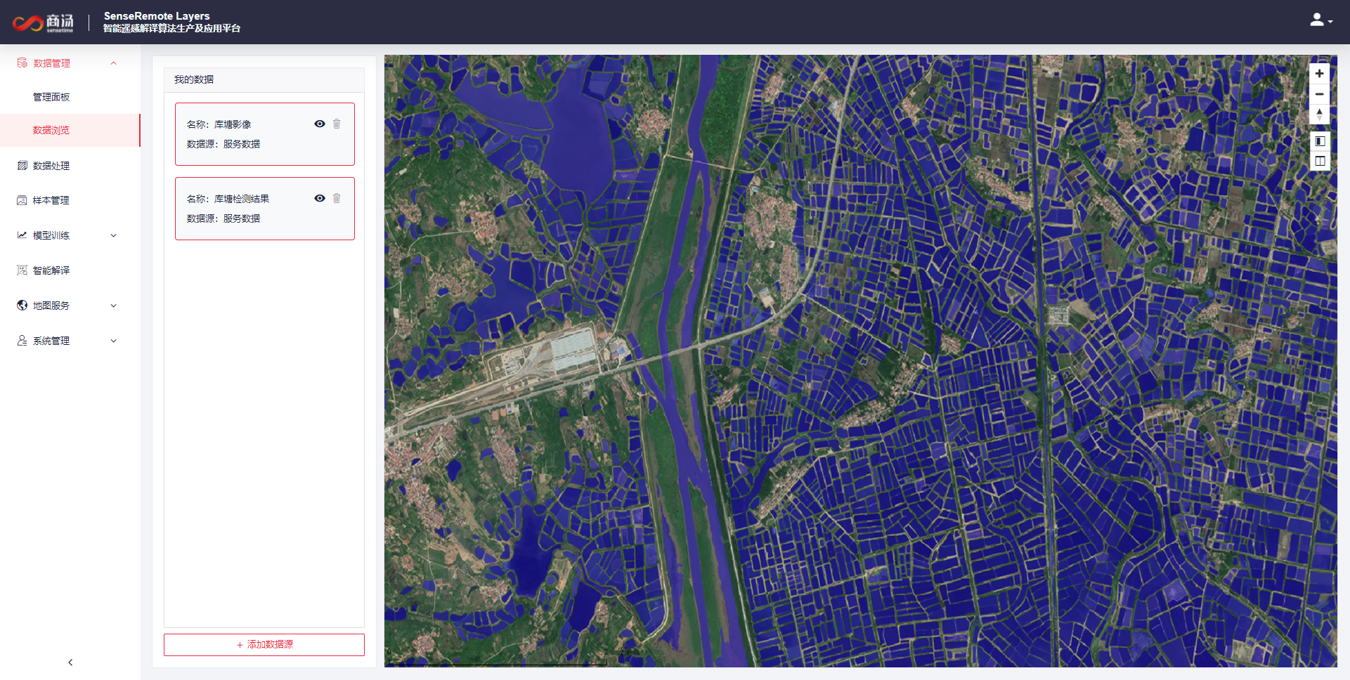
Continuous Improvement of Geospatial Analytics Algorithms for Specific Application Scenarios
In Wuhan, Hubei Province, the platform effectively helps in model iterations for pond detection, leading to improved analysis accuracy and reduced manual workload.
In Wuhan, Hubei Province, the platform effectively helps in model iterations for pond detection, leading to improved analysis accuracy and reduced manual workload.
All Products